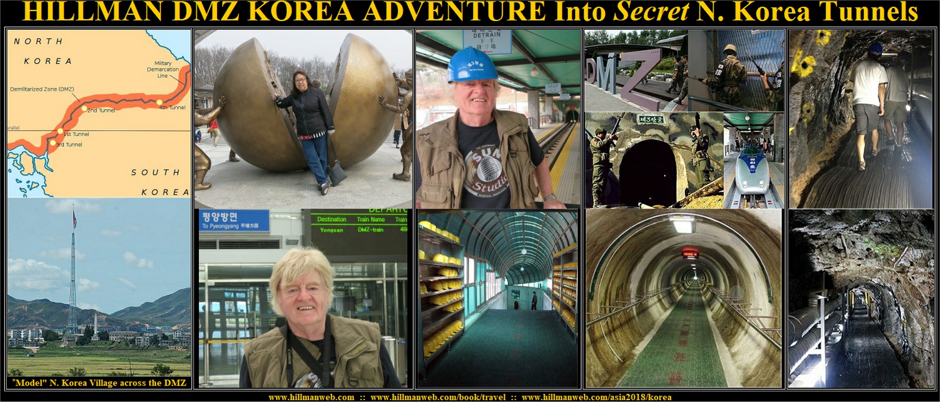
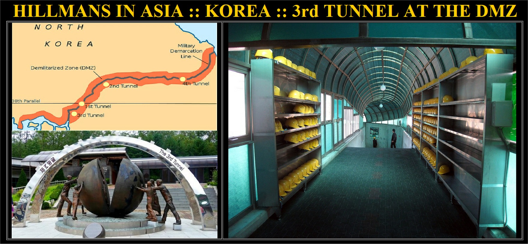
EXPLORING SECRET TUNNEL #3
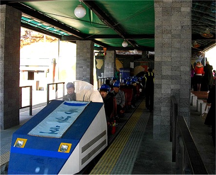
This Tunnel #3 is now a tourist site, though still well
guarded. Rather than walking down the long steep incline that starts in
a lobby with a gift shop we went via a train with padded seats facing forward
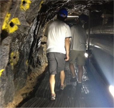
and backwards in rows for up to three passengers each. Photography was
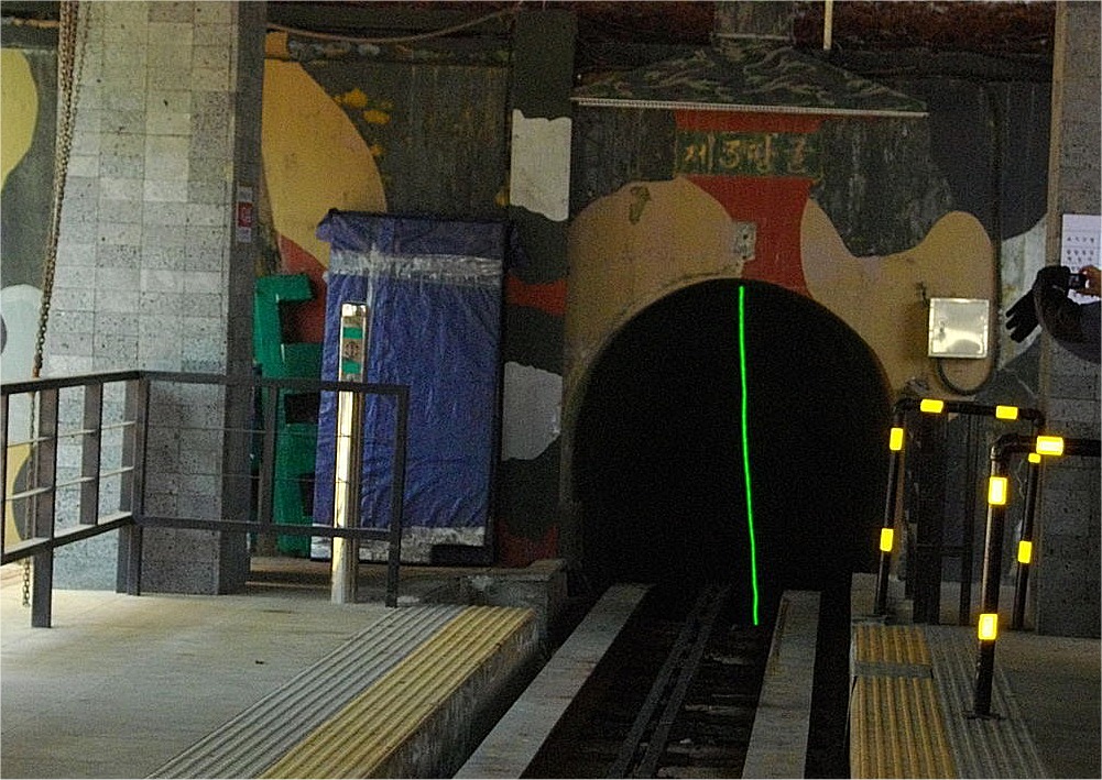
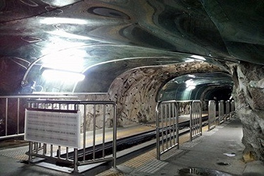
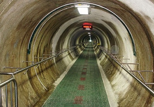
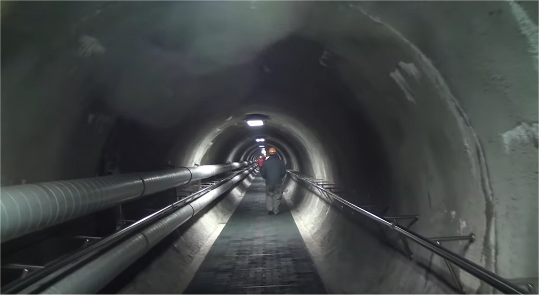
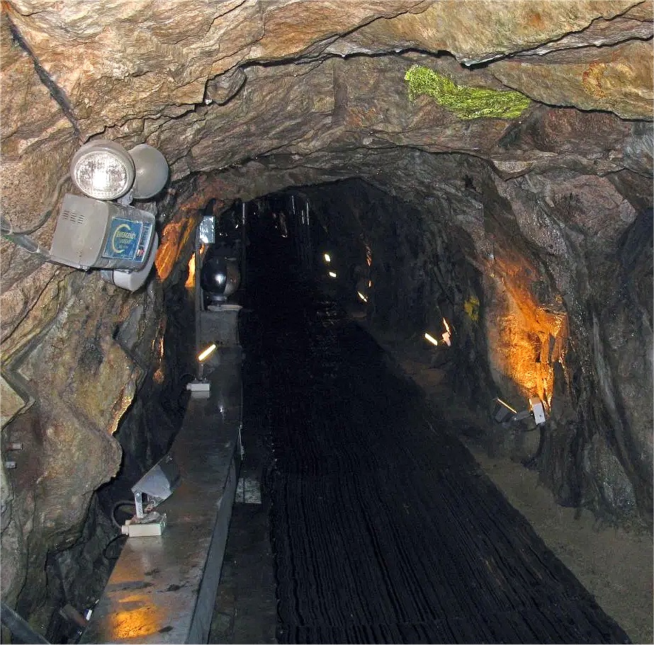
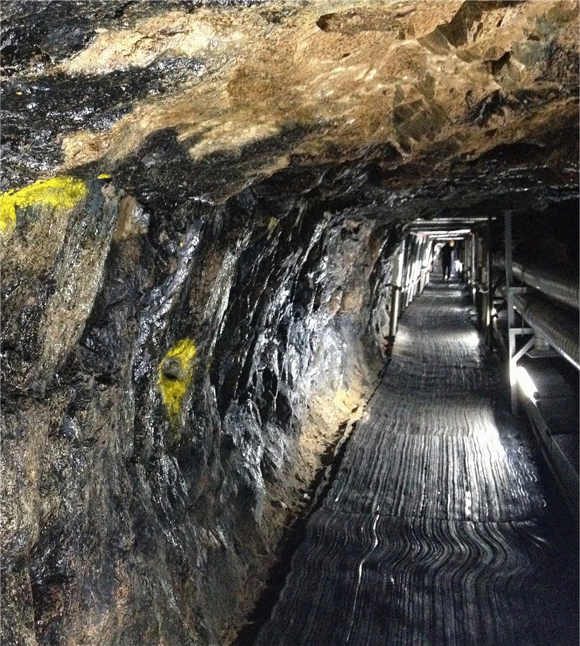
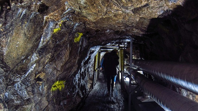
forbidden within the tunnel so we are sharing some stock photos.
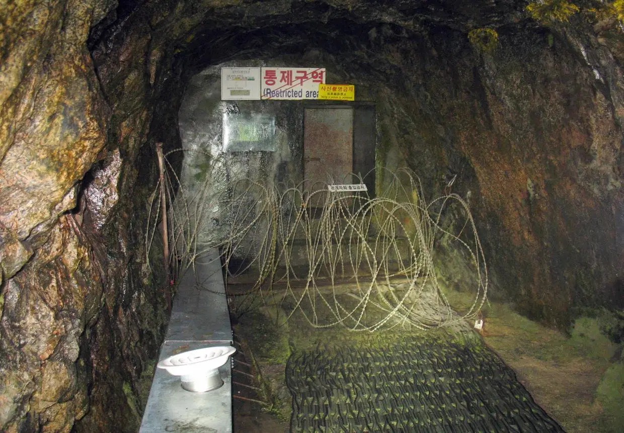
The South Koreans have blocked the actual Military
Demarcation Line in the tunnel with three concrete barricades. We walked
as far as the third barricade with its barbed wire and machine gun nests,
but the second barricade was visible through a small window. We were just
over 100 metres from the North Korea border.
Background Info on the
"Third Secret Tunnel" that we visited at the DMZ.
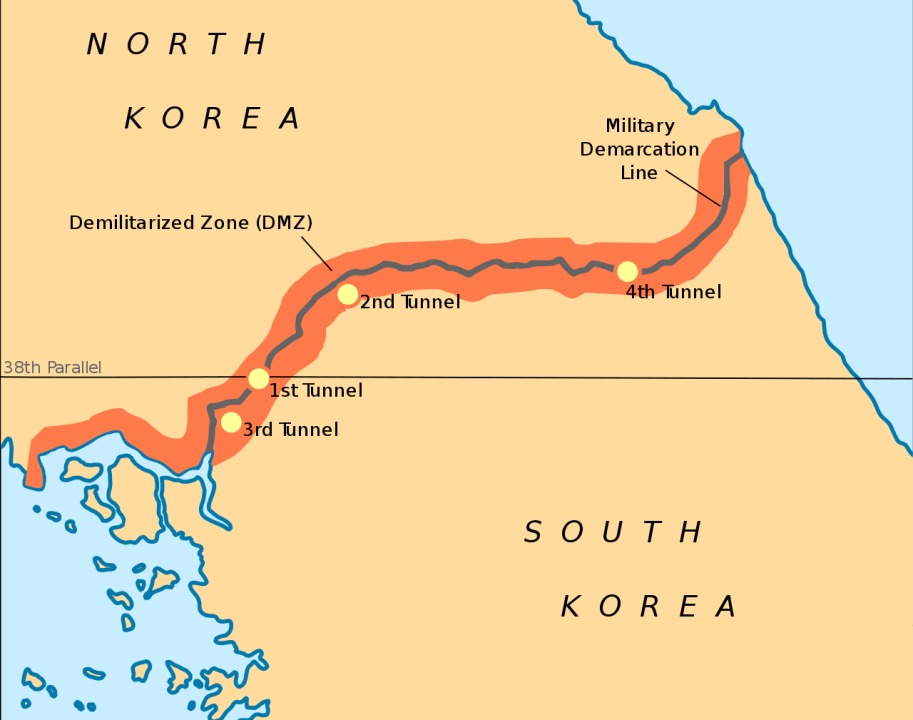
Since November 15, 1974, the South has discovered that
four tunnels crossing the DMZ have been dug by North Korea. This is indicated
by the orientation of the blasting lines within each tunnel. Upon their
discovery, North Korea claimed that the tunnels were for coal mining. However
no coal has been found in the tunnels, which are dug through granite, but
some of the tunnel walls have been painted black to give the appearance
of anthracite.
The tunnels are believed to have been planned as a
military invasion route by North Korea. Each shaft is large enough to permit
the passage of an entire infantry division in one hour, though the tunnels
are not wide enough for tanks of vehicles. All the tunnels run in a north-south
direction and do not have branches. Following each discovery, engineering
within the tunnels has become progressively more advanced. For example,
the third tunnel sloped slightly upwards as it progressed southward, to
prevent water stagnation. Today, visitors may visit the second, third and
fourth tunnels through guided tours.
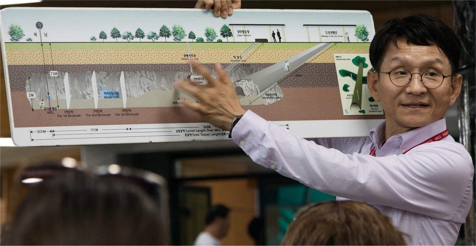
Only 44 kilometers from Seoul the third tunnel was
discovered in October 1978. It is similar in size and build to the
other three tunnels that have been discovered: 1.635 kilometers long, 1.95
meters high and 2.1 meters wide. It penetrates 435 meters south of the
Military Demarcation Line at a point 4 kilometers south of the armistice
village of Panmunjeom, running through bedrock at a depth of about 73 meters
below ground. Capable of moving a full division (plus their weapons) per
hour, with the intention of clandestinely infiltrating them into the rear
areas of the South to form a second front. it was evidently designed for
a surprise attack on Seoul. This tunnel is only 2 kilometers from a key
outpost defending the Munsan corridor leading to Seoul.
The buffer zone that falls south of the Southern Limit
Line is called the Civilian Control Zone. Barbed wire fences and manned
military guard posts mark the Civilian Control Line. The Civilian Control
Zone is necessary for the military to monitor civilian travel to tourist
destinations close to the Southern Limit Line of the DMZ like the discovered
infiltration tunnels and tourist observatories. Usually when traveling
within the Civilian Control Zone, South Korean soldiers accompany tourist
buses and cars as armed guards to monitor the civilians as well as to protect
them from North Korean intruders.
The CCL fence acts more as a deterrent for South Korean
civilians from getting too close to the dangerous DMZ and is also the final
barrier for North Korean infiltrators if they get past the Southern Limit
Line DMZ fence.
Right after the ceasefire, the Civilian Control Zone
outside the DMZ encompassed 100 or so empty villages. The government implemented
migration measures to attract settlers into the area. As a result, in 1983,
when the area delineated by the Civilian Control Line was at its largest,
a total of 39,725 residents in 8,799 households were living in the 81 villages
located within the Civilian Control Zone.
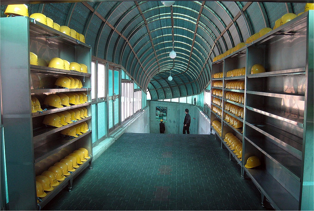
NOTE: We had to check-in our cameras before decending
since security does not allow photos to be taken.
Most of the photos that we've displayed on this page
are from media sources.


 .
.
 .
.