BRANDON COLOUR PHOTO ARCHIVE 48
www.hillmanweb.com/brandon/48.html

THE GREAT MANITOBA FLOOD OF 2011
Part II
AERIAL PHOTOS BY DALE SCHAPPERT
www.photographybydale.ca
Unit B-658-10th Street ~ Brandon, Manitoba, R7A 4G5
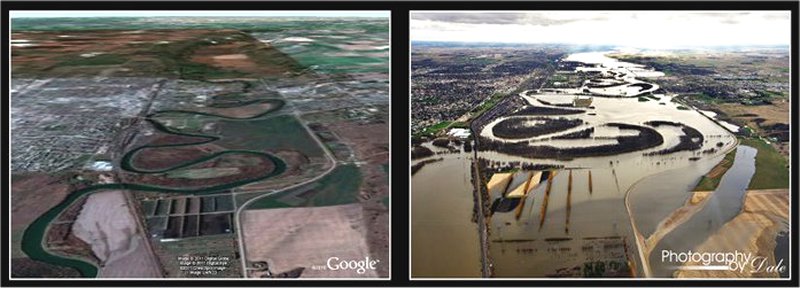
Then and Now Comparisons with Google Earth
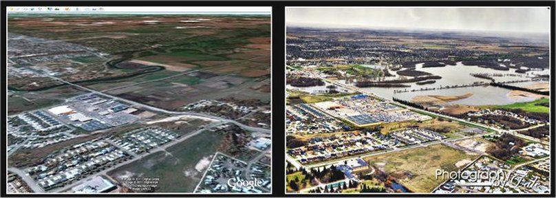
Dinsdale Park and 1st Street
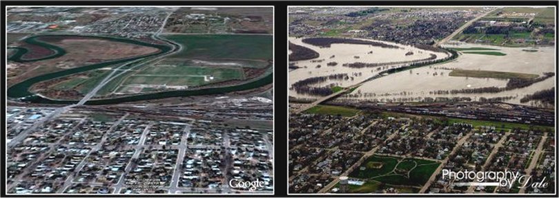
1st Street and Soccer Park
18th Street to 1st Street looking north, the areas
shaded in orange
are currently under a Precautionary Mandatory Evacuation
Order.
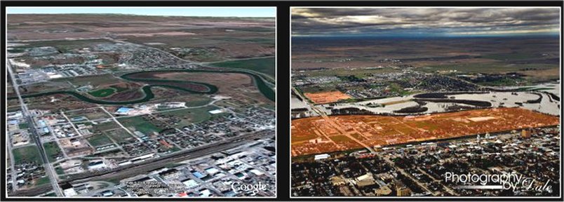
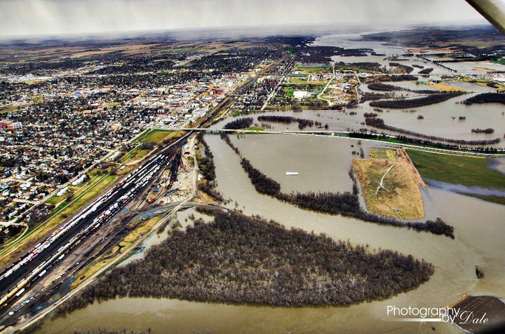
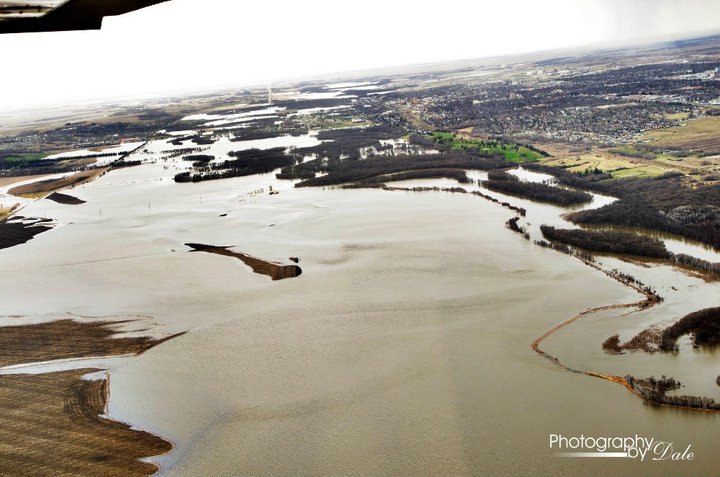
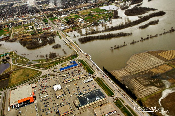
Overlooking the Corral Center
Looking west towards Brandon above Riverbend Park
on the low road to Shilo.
![]()
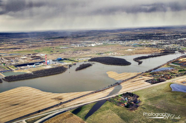
North of the Hydro Plant in Brandon, Manitoba
![]()
Eastern Access Hwy 110
![]()
Willow Creek on low road to Shilo
![]()
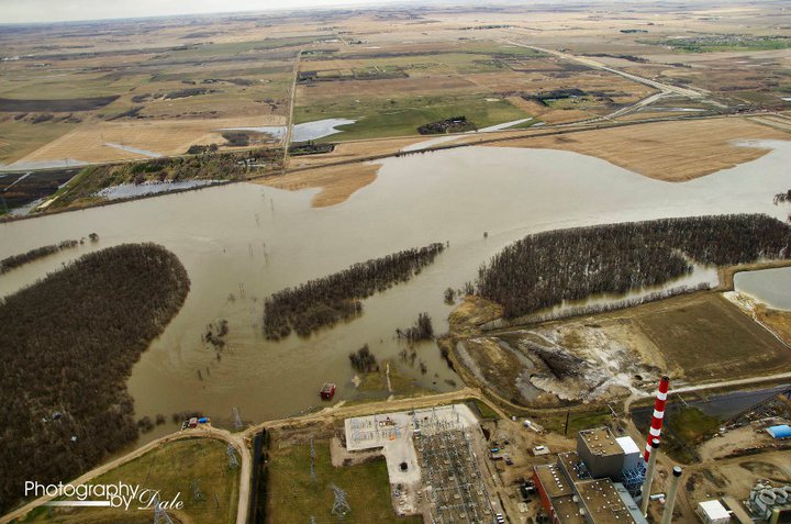
Looking north of Hydro Plant
![]()
Looking west toward 1st Street soccer park.
![]()
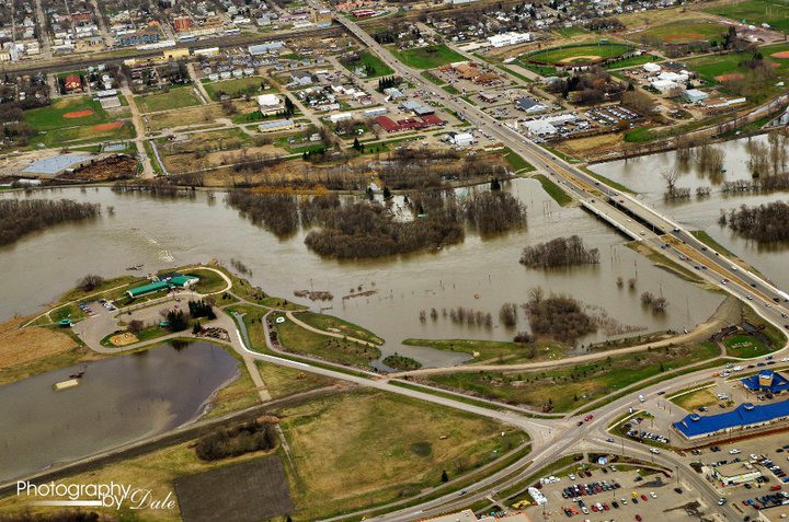
Intersection of Veterans Way and 1st Street
![]()
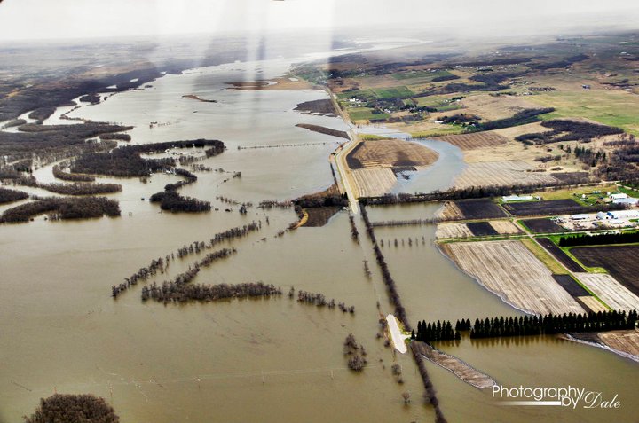
Grand Valley Road. Line of trees on the right is the
entrance to the Brandon Research Station.
![]()
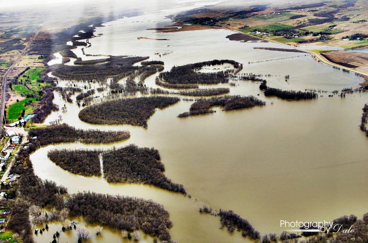
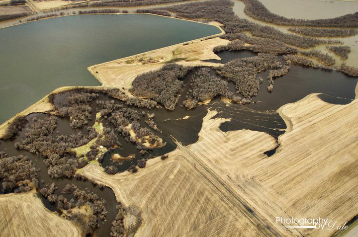
Flood in between the Wheat City Golf Course and Grand
Valley Road
![]()
Queen Elizabeth Park behind the Brandon Water Treatment
Plant.
![]()
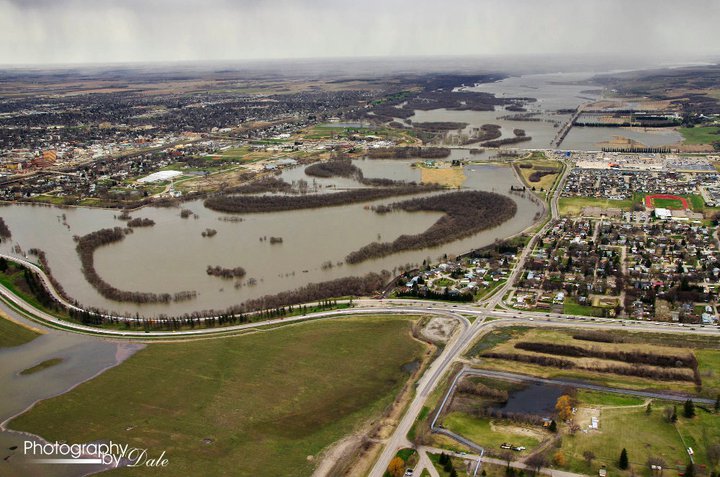
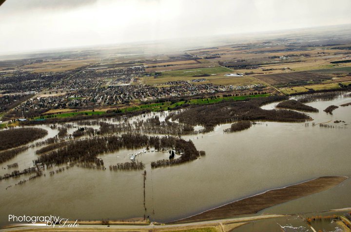
Looking east toward Brandon
![]()
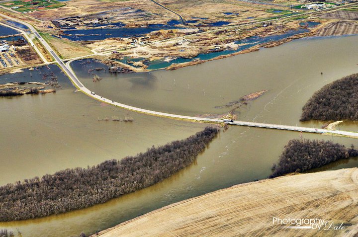
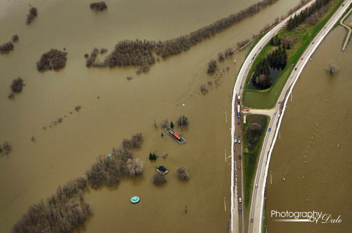
Turtle Crossing just south of the Grand Valley Road
![]()
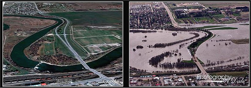
Overlooking the Corral Center
![]()
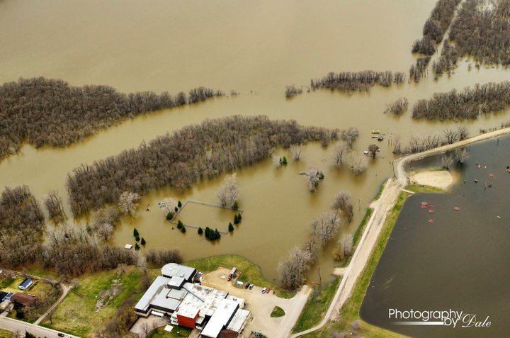
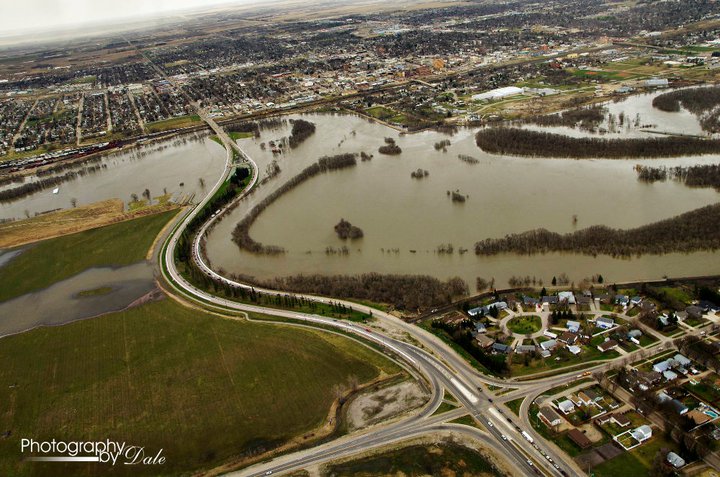
Riverbank Discovery Center and 18th Street
![]()

Flood just south of Kirkcaldy
![]()
Intersection at Veterans Way and 1st Street
![]()
Dinsdale Park on 1st Street
![]()
See many more of these remarkable photos at Dale's FaceBook Page
where permission for sharing is given.
www.facebook.com/photobydale
![]()
Photo
Memories From
The
Hillman Archives
.![]()
![]()
![]()
![]()
Manitoba Photo Memories From The Bill Hillman
Archives
Archive
Directory | 01
| 02 | 03
| 04 | 05
| 06 | 07
| 08 | 09
| 10 | 11
| 12 | 13
| 14 | 15
| 16 | 17
| 18 | 19
| 20 |
21
| 22 | 23
| 24 | 25
| 26 | 27
| 28 | 29
| 30 | 31
| 32 | 33
| 34 | 35
| 36 | 37
| 38 | 39
| 40 |
41
| 42 | 43
| 44 | 45
| 46 | 47
| 48 | 49
| 50 | 51
| 52 | 53
| 54 | 55
| 56 | 57
| 58 | 59
| 60
61
| 62 | 63
| 64 | 65
| 66 | 67
| 68 |
William
Hillman
Bill
and Sue-On Hillman Eclectic Studio
www.hillmanweb.com